")
Step 1: Identify the precinct type and define the precinct boundaries

- CBDs
- Secondary CBDs or primary nodes
- Secondary nodes
- Neighbourhood activity centers
- Areas of concentrated mixed use such as commercial, retail, food and hospitality, civic/community, higher-density housing, entertainment services.
- Vary in size and function
- Good accessibility
- Regeneration (CBDs) and upgrading (emerging nodes)
- Mixed use, zoning, sub-division and other development controls to enable higher density, compact development
- Network of streets and public spaces that deliver a pedestrian-focussed public realm with a strong focus is on activity on key public streets
- Transport integration with both surrounding areas and the broader urban network
- Urban corridors both connect activity centres and strengthen major routes including public transport.
- Offer opportunities to accommodate nodes of higher density residential and mixed use development near good quality, high frequency public transport, thereby increasing urban accessibility and the viability of public transport systems.
- Integration zone nodes
- Corridors along main urban arteries
- Activity spines
- Local area high street
- Regeneration (CBDs) and upgrading (emerging nodes)
- Infill and densification
- Land and human settlements development
- Economic infrastructure investments, such as upgrading of business districts, the provision of improved street and pavement infrastructure and open space systems
- Public transport infrastructure and services
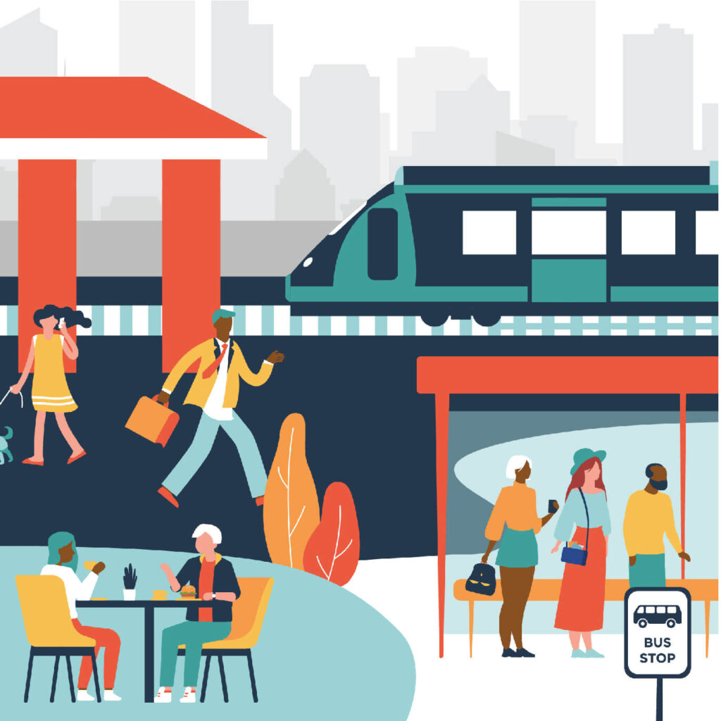
- Areas that feature transit-oriented development surrounding railway stations and other transport interchanges.
- These precincts range from major centres of transit and urban activity, to smaller centres focussed around local stations and taxi ranks
- Transport interchanges
- Urban hubs
- Mixed use development including higher density residential development, retail and social services
- Designing the movement network, streetscape and public realm to ensure safe and inviting linkages by all modes between the surrounding precinct and public transport infrastructure.
- Facilitating public transport use by ensuring transit infrastructure within the precinct is integrated with surrounding development and promotes ease of access for residents and visitors.

- May be general purpose or purpose/theme-specific with a particular economic focus, e.g. automotive manufacturing and related services, technology development, agro-processing etc.
- Various models exist e.g. privately-owned parks, associations of tenant companies, PPPs and government-owned parks
- Industrial parks
- Logistics parks
- Special economic zones (SEZs)
- Ports
- New development (greenfields) or regeneration and retention (brownfields)
- Strong focus on climate change adaptation and resilience
- Safety and security
- Bulk infrastructure services (industrial parks)
- Circular economy
The purpose of this step is to derive at a defined study area and area for intervention through design, planning and management. Precincts will have been broadly identified through the processes of urban network analysis and integration zone planning. This will have been done on the basis of identification of nodes i.e. CBDs, primary nodes, intermediary and locations in under-served townships suitable for urban hub development.
| Considerations | Explanation |
|---|---|
| Built objectives | These include targets for gross residential density, bulk (floor area) and mixed use – see Table 2 in Section 1 |
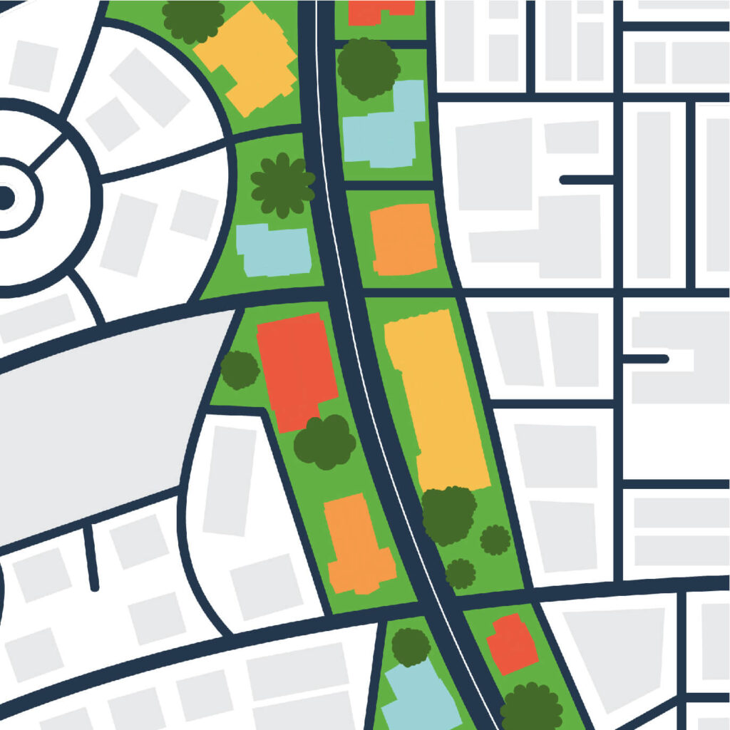
| Walkability | For multipurpose precincts, urban hubs included, the precinct boundary is generally set at 800m (10 minute walking distance) from the center of the precinct |
| Land status and ownership | Key considerations include the distribution of land ownership (state-owned, municipal and private) as well as the degree of fragmentation |
| Land use and zoning | The degree of land use mix may influence the decision to intervene or not, and if so, to what extent. It may also be appropriate to create a transition zone between the precinct and surrounding areas |
| Type, extent and concentration/distribution of transport infrastructure | This includes current and/or proposed train stations and bus stations, railways, major roads and intersections |
| Built form and character | The age, character/style and condition of buildings with similar and/or complimentary features can be combined to create an unified identity |
| Heritage assets | Historic and other culturally significant assets, and other assets that draw tourism may be linked to create tourism paths or routes, and themes for the precinct |
| Geographical and environmental features | Topography and especially slope may affect the walkability and the extent of the precinct. The soil type may additionally affect building costs. Both slope and soil type can affect infrastructure development costs. Some environmental features such as waterways and wetlands may be environmentally protected areas, and construction may be prohibited. Flood lines, where applicable, need to be considered. Conversely, waterways, green areas and other environmental features can, through appropriate design, simultaneously enrich the precinct and enhance the natural environment. |
| Climate risk | Climate risk exposure, depending on the nature, extent and severity of exposure, may affect the selection of precinct boundaries |
| Extent, type and distribution and social amenities | It may be desirable to adjust precinct boundaries to incorporate existing or planned social amenities with the potential to contribute to the activation/elevation of the precinct through increased activity, or to exclude those social amenities that detract from the precinct objectives e.g. large cemeteries or landfill transfer stations. |
| Infrastructure coverage and considerations | Ideally, where feasible precinct boundaries should consider infrastructure availability and lifecycle costs of infrastructure catchment areas and solutions |
| Major projects | Also consider planned projects or projects being implemented in the area under consideration, and how this may affect the proposed precinct |
| Other | There may be other valid considerations that are typically site specific, for example key views, sight lines, wind conditions etc. |
It is possible that the status quo assessment points to the need to adjust the precinct boundaries. Precinct boundaries may also need to be adjusted during detailed design due to needs of opportunities that present themselves during, for example, the design of the access and movement framework. However, there must be a starting point and defined area for study and design.
It is also useful to assess aerial or satellite photography when initially determining precinct boundaries, and to conduct a walk-through to identify main design issues and urban features (both those that are unsuccessful and those that are not). It informs further work required. Key observations are generally recorded by way of annotated layout plans or printed aerial photographs and supplemented by photos taken during the walk-through.
The general considerations for defining precinct boundaries also apply to urban hubs. However, since the urban hub is essentially a transit oriented hub (station hub), the major transport facility form the heart of the precinct, and the precinct boundary area and boundary is then progressively defined as follows:
- Locate the major transport facility e.g. train station or bus station. This lies at the heart of the precinct.
- The core of the precinct. The core of the precinct is the area surrounding the major transport facility that is easily accessible on foot. Within urban hubs, the core of the precinct is the 800m walkshed.
- The precinct boundary. Depending on the functional structure of the area, distribution of land uses and key facilities, the extent of land fragmentation and topographical features and constraints and other factors (see table above), the precinct boundary may be broader than the 800m walkshed determined for urban hubs (and will almost certainly be broader for CBDs and strong primary nodes).
- Context must be established for analysis, planning and design purposes. The precinct will not function in isolation. People in surrounding areas can and should utilise the precinct on a regular basis and should increase both traffic and demand within the precinct.


